Please read and agree to the
terms and conditions
of this site.
I agree
Transportation
/tech
Clear filters and search
Format
photo
Tags
apple maps
apple
featured
mapping
news
coronavirus
datascience
europe
france
germany
google
insider
ipad
iphone
ipod touch
mac
maps
neural
push
rstats
spain
the wall street journal
transit
transit directions
What
maps
9
×
public
9
×
transport
google
directions
transit
apple
live
new
users
bunch
cities
covid
europe
expanded
features
help
information
look
access
according
added
alerts
anecdotal
animating
announced
appealing
asia
authorities
availability
avoid
bearable
book
case
choose
clear
closures
coax
collected
comes
Language
unset
9
×
Current search:
maps
×
unset
×
public
×
@macrumors.com
9 months ago
Apple Maps Gradually Winning Over Haters, Report Suggests
@icymi_r
2 years ago
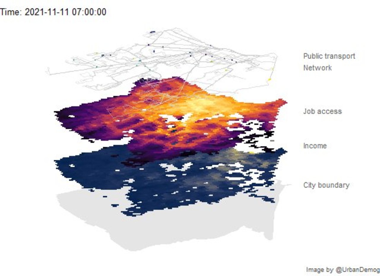
✍️ Animating public transport networks on 3D stacked maps | Urban Demographics Rafael H. M. Pereira @urbandemog https://www.urbandemographics.org/post/animating-transport-networks-3d-maps/ #rstats #datascience https://t.co/x15IdnUrZP
@thenextweb.com
2 years ago
Google’s new crowd predictions for Maps may coax me back onto subways
@zdnet.com
3 years ago
Google Maps to share COVID-19 case count and public transport occupancy details
@neowin.net
3 years ago
DuckDuckGo now offers private driving and walking directions
@idownloadblog.com
3 years ago
Apple Maps updates for Look Around, Nearby and public transit live in Europe, Asia & more
@thenextweb.com
3 years ago
Google Maps now tells you when a face mask is required on public transport
@zdnet.com
3 years ago
Google Maps rolls out COVID-19 transit alerts
@idownloadblog.com
4 years ago
Apple Maps expands its transit directions coverage across Europe