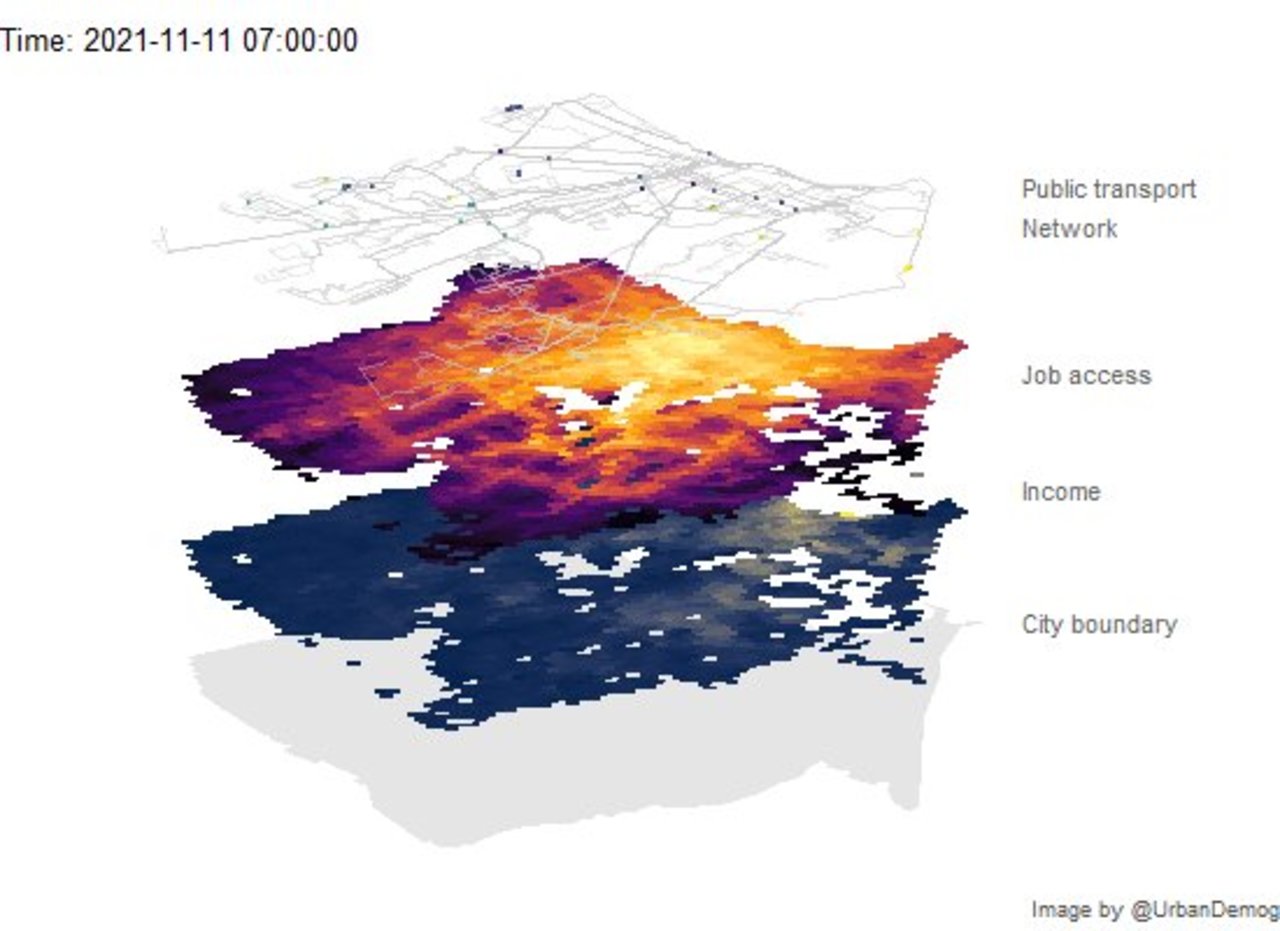
✍️ Animating public transport networks on 3D stacked maps | Urban Demographics Rafael H. M. Pereira @urbandemog https://www.urbandemographics.org/post/animating-transport-networks-3d-maps/ #rstats #datascience https://t.co/x15IdnUrZP
✍️ The 5-minute learn: Create pretty and geographically accurate transport maps in R | Learn to plot the London Tube network accurately. Keith McNulty @dr_keithmcnulty https://towardsdatascience.com/the-5-minute-learn-create-pretty-and-geographically-accurate-transport-maps-in-r-63f2cb77c227 #rstats #datascience
gtfs2gps • Converting public transport data from GTFS format to GPS-like records Rafael H.M. Pereira @urbandemog, Pedro R. Andrade, Joao Bazzo @joaopbazzo https://github.com/ipeaGIT/gtfs2gps #rstats #datascience https://t.co/RL71gMeqco
️️ Open Source Tools for Geographic and Transport Research Robin Lovelace @robinlovelace, ReproducibiliTea @reproducibilit https://www.robinlovelace.net/presentations/reproducibilitea.html #rstats #datascience https://t.co/NJg9WYcfXM