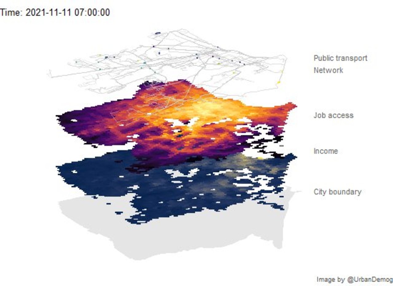
✍️ Animating public transport networks on 3D stacked maps | Urban Demographics Rafael H. M. Pereira @urbandemog https://www.urbandemographics.org/post/animating-transport-networks-3d-maps/ #rstats #datascience https://t.co/x15IdnUrZP
gtfs2gps • Converting public transport data from GTFS format to GPS-like records Rafael H.M. Pereira @urbandemog, Pedro R. Andrade, Joao Bazzo @joaopbazzo https://github.com/ipeaGIT/gtfs2gps #rstats #datascience https://t.co/RL71gMeqco
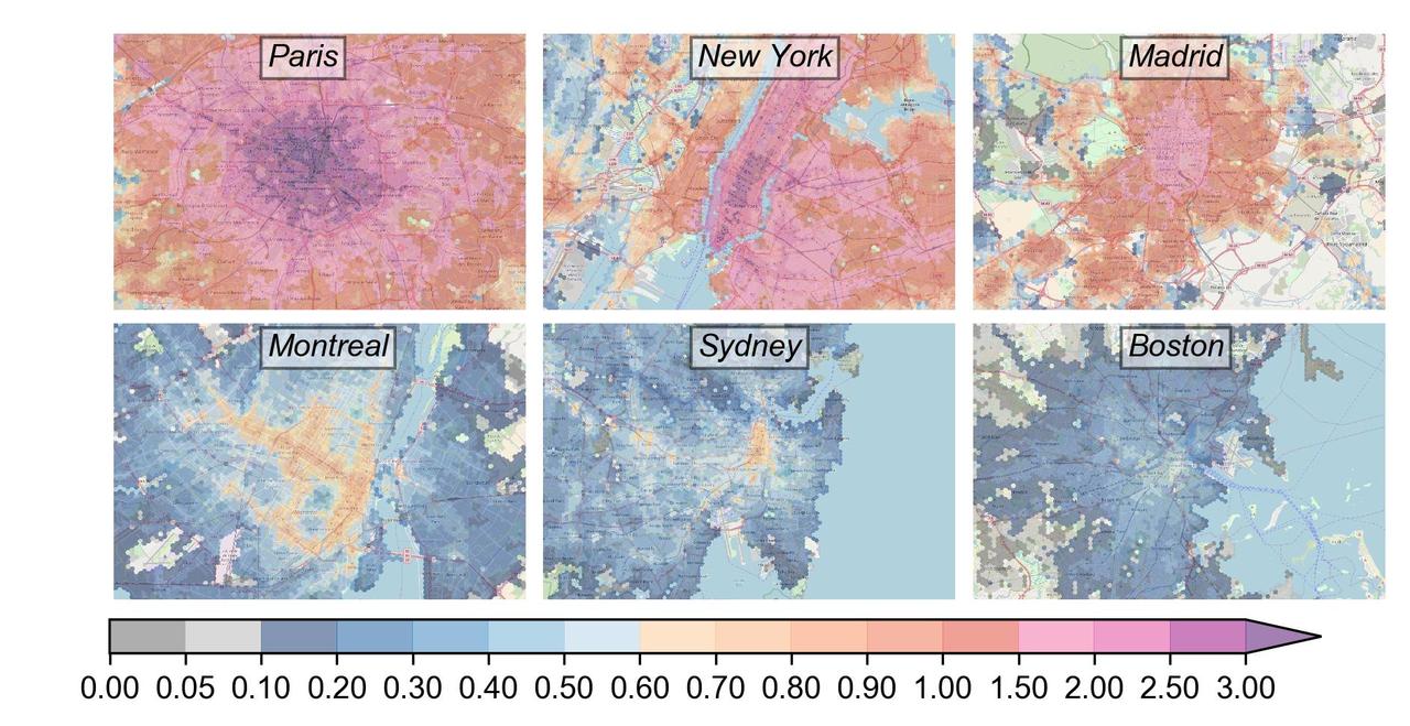
Our last work on the performance of urban public transport is out! What are the best performing cities? Is the public transport well distributed among people? Check it out: https://royalsocietypublishing.org/doi/10.1098/rsos.190979 http://www.citychrone.org #transport #citychrone #DataScience #dataviz #maps https://t.co/M7PEwLV1qg