Please read and agree to the
terms and conditions
of this site.
I agree
Transportation
/tech
Clear filters and search
Format
photo
link
Tags
google
apple
apps
mobile
airmap
apple maps
australia
business
category-/business & industrial
category-/reference/geographic reference/maps
citymapper
design & dev
drone
dronedeploy
europe
google maps
mapbox
mapillary
maps
media
moovit
tc
tech
transportation
waze
What
city
7
×
maps
7
×
google
public
transport
app
apple
bus
cities
new
transit
navigation
use
world
data
directions
ease
ferry
finally
help
ios
launches
navigate
options
starting
subway
train
transportation
adding
android
announced
appleinsider
australia
australia's
available
biggest
blog
bring
buses
calculate
Language
Current search:
maps
×
city
×
@venturebeat.com
4 years ago
Connected city and transport demands are fueling smarter maps
@mashable.com
6 years ago
Google Maps now shows real-time public transport data in Australia's largest city
@techcrunch.com
7 years ago
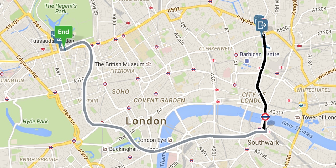
Apple Maps gets transit mode for Paris
@theverge.com
8 years ago
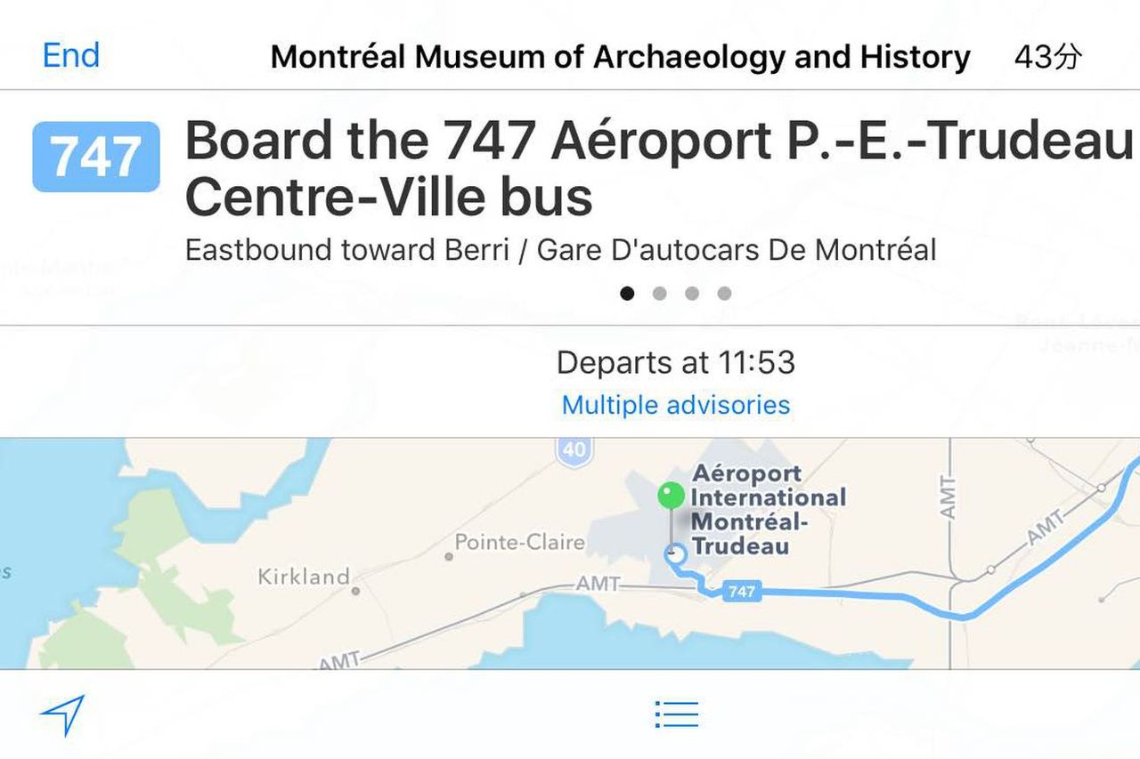
Apple Maps now has public transit directions in Montreal
@venturebeat.com
8 years ago
Google launches its first dedicated public transport app, but for New Delhi residents only
@thenextweb.com
8 years ago
Citymapper’s ‘Project Istanbul’ will help it bring excellent transit navigation to more cities
@WIRED
8 years ago
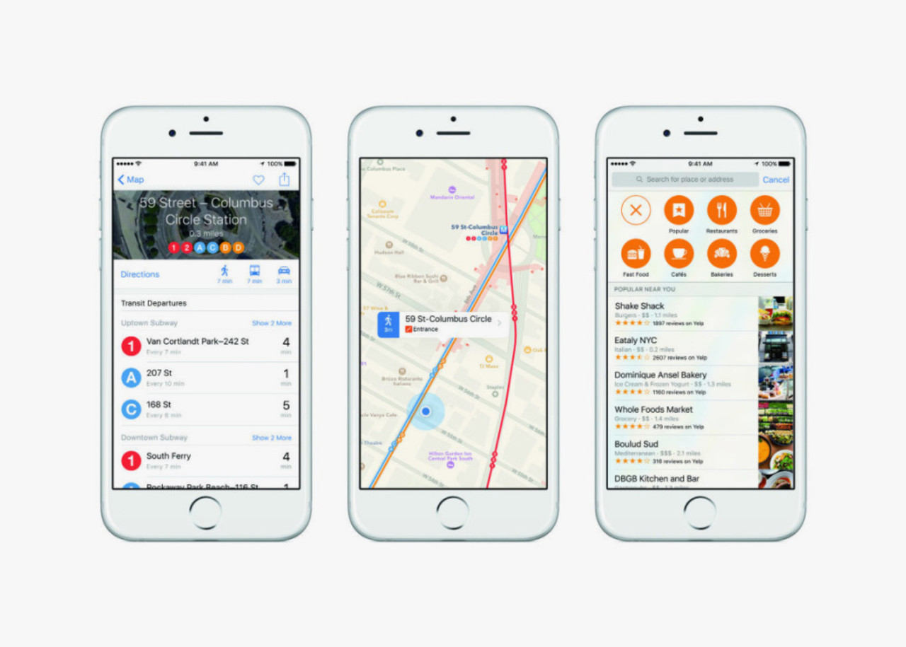
When iOS 9 launches in the fall, public transportation navigation data will be available for 10 cities across the United States.