@icymi_r 2 years ago
✍️ Animating public transport networks on 3D stacked maps | Urban Demographics Rafael H. M. Pereira @urbandemog https://www.urbandemographics.org/post/animating-transport-networks-3d-maps/ #rstats #datascience https://t.co/x15IdnUrZP
@dr_keithmcnulty 2 years ago
Short tutorial I just wrote on layering graph structures on top of maps to accurately portray transport networks. #rstats #r4ds #DataScience https://towardsdatascience.com/the-5-minute-learn-create-pretty-and-geographically-accurate-transport-maps-in-r-63f2cb77c227?source=social.tw
@turinginst 3 years ago
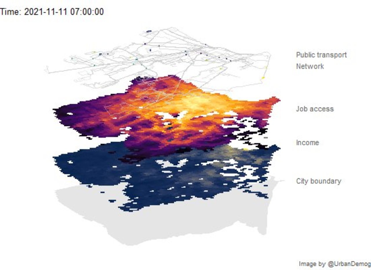
➡️Read our NEW #TuringBlog From toxic online communities to city transport patterns, software developed at the Turing is shedding new light on how networks evolve: https://bit.ly/3mF33vK #DataScience #AI #Artificialintelligence #BigData (Image: Sunward Art / Shutterstock) https://t.co/hgxf83YaUe
@IainLJBrown 5 years ago
Journeys in big data and AI across the transport networks of London & Paris Read more here: https://ift.tt/2E6bvDc #BigData #DataScience #MachineLearning #DeepLearning #NLP #Robots #AI #IoT