Please read and agree to the
terms and conditions
of this site.
I agree
Transportation
/tech
Clear filters and search
Format
photo
Tags
apps
apple
mobile
moovit
airmap
apple maps
asia
bangalore
bluetooth
business
category-/business & industrial
category-/reference/geographic reference/maps
drone
dronedeploy
drones
europe
featured
gadgets
gear
gear / trends
google
ibeacons
india
insider
ipad
iphone
ipod touch
mac
mapbox
mapillary
mapping
maps
media
news
product updates
public transport
push
shift
singapore
subways
What
mapping
9
×
transport
9
×
city
help
design
new
public
transit
app
apple
audio
based
drones
lines
london
maps
mobility
navigate
nearby
service
software
time
today
town
updates
used
users
using
access
aerial
allows
android
applications
apps
arrived
article
asia
audience
augmented
automatically
Language
unset
Current search:
mapping
×
transport
×
@wired.com
2 years ago
Augmented Reality Has Already Arrived—In Our Ears
@thenextweb.com
3 years ago
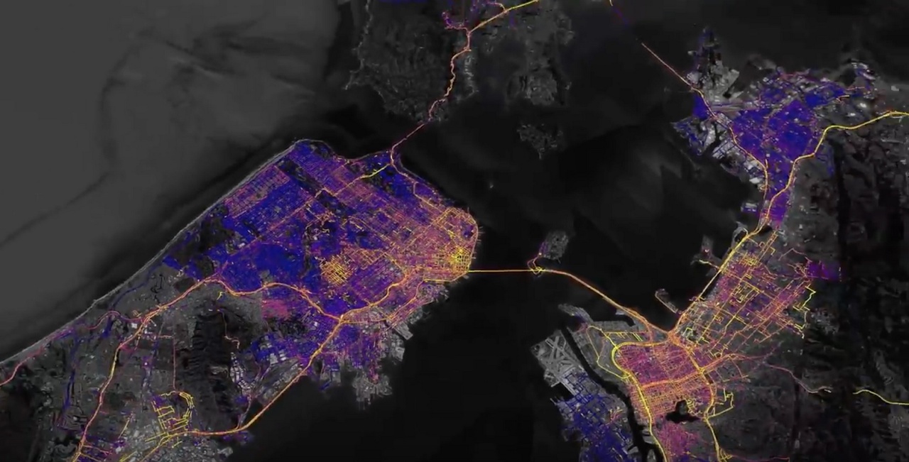
How Bangkok’s 40,000-kilometer transport network was mapped for the first time
@idownloadblog.com
3 years ago
Apple Maps updates for Look Around, Nearby and public transit live in Europe, Asia & more
@venturebeat.com
4 years ago
Connected city and transport demands are fueling smarter maps
@mashable.com
7 years ago
Drones and UAVs are going to help inspect our subway tunnels
@thenextweb.com
8 years ago
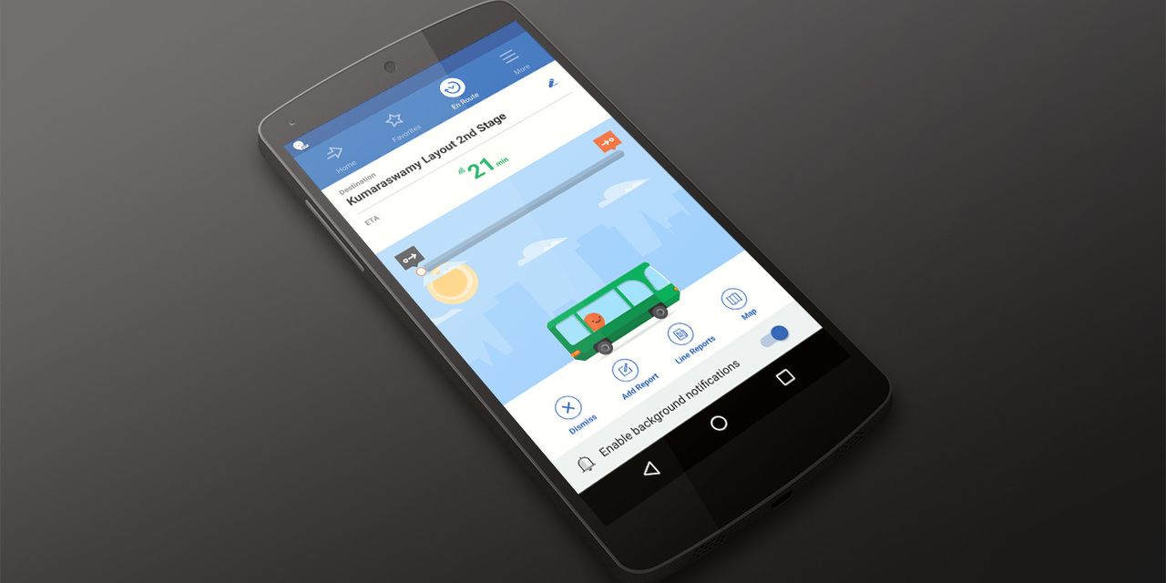
Moovit brings its public transit mapping service to India, starting with Bangalore
@pmarca
8 years ago
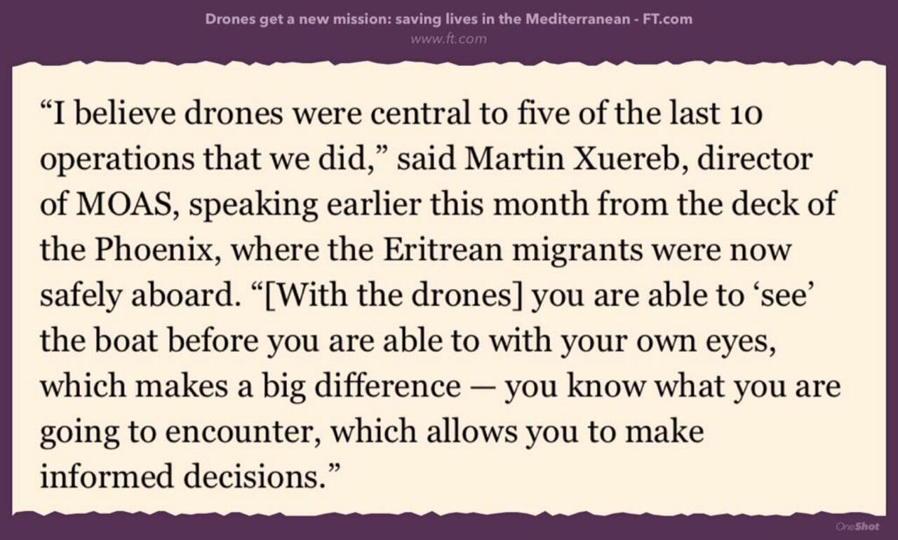
RT @SuB8u: Drones are increasingly used to help in humanitarian disasters -search, transport, mapping... http://www.ft.com/intl/cms/s/0/ca1be56c-158f-11e5-8e6a-00144feabdc0.html#axzz3eCN8VZoO http://t.co/F8m8RmUpDq
@thenextweb.com
9 years ago
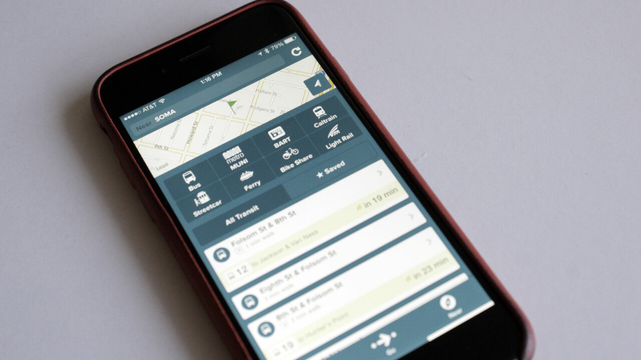
Citymapper receives a design overhaul with quicker access to saved trips and nearby transportation
@techcrunch.com
9 years ago
Can iBeacons Be Used To Help The Visually Impaired Navigate Public Transport?