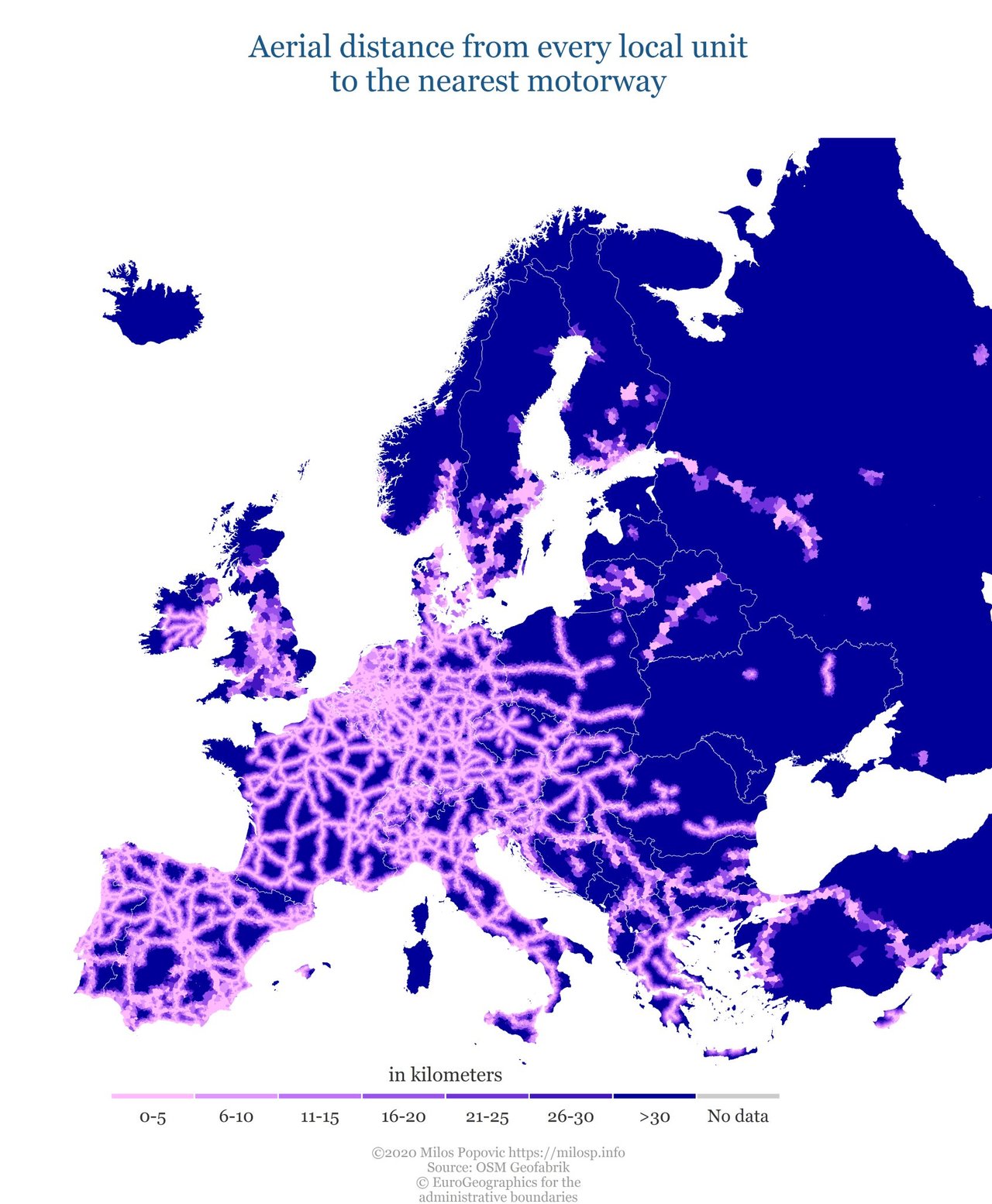
How far is the motorway from the centroid of every local admin. unit in Europe. Check out my latest map! #roads #transport #dataviz #datascience #bigdata #maps #rstats https://t.co/wmS7LEXspJ
Dubai's RTA uses AI to map bus routes according to usage - Intelligent Transport Read more here: https://ift.tt/2Fc11TU #ArtificialIntelligence #AI #DataScience #MachineLearning #BigData #DeepLearning #NLP #Robots #IoT